
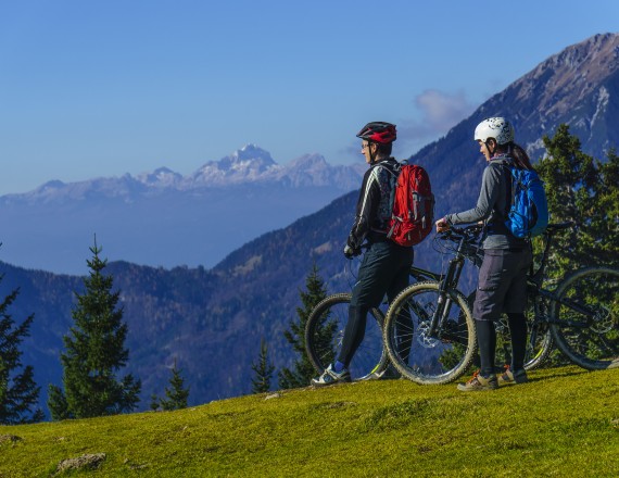
Trans Karavanke MTB Trail
Mountain biking beneath the peaks of the Karawanks range. The greatest reward along the 132-km long trail with an altitude difference of 5,700 m will be the spectacular views and enjoyment in a pristine natural environment.
 1 / 9 Trans Karavanke MTB Trail
- type of path: mountainbike length: 132 km / elevation change: 5.700 m difficulty: ***** - technical: **** - condition: ***** panorama: *****
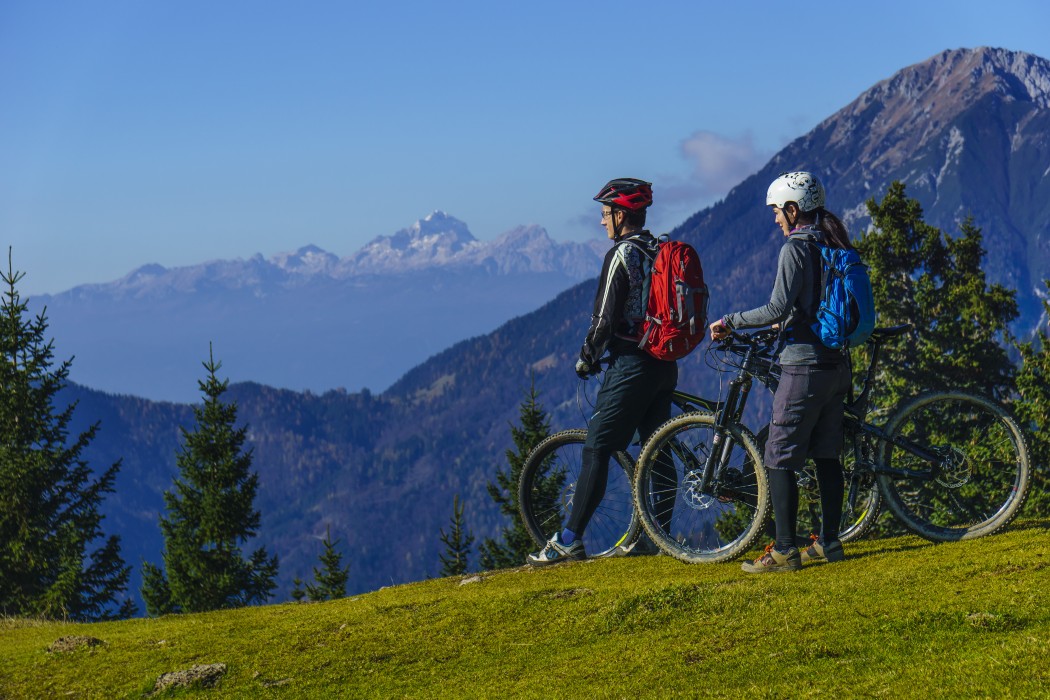
The Trans Karavanke MTB Trail extends from Jezersko to Tromeja and can also be travelled in the opposite direction. Mostly it runs along forest roads on the sunny slopes of the Karavanke Mountains, and only climbs to a peak and the border with Austria at its westernmost point, Peč, or Tromeja (the tri-border).
The trail was created within the Alpe Adria Karavanke/Karawanken project, implemented in the frame of the Cooperation Programme Interreg V-A Slovenija-Avstrija and co-financed by the European Fund for Regional Development.
The 132 km, which are divided into 5 stages, includes visits to the Slovenian Alpine Museum in Mojstrana, Tržič, the Dovžan Gorge and several popular mountain outposts (Valvasor's Lodge under Stol, Dom Pristava in Javorniški Rovt, Alpine Lodge at Zelenica, Dom na Kofcah), but the biggest prize will be beautiful views and enjoying the unspoiled nature.
The trail is suitable for well-prepared mountain bikers, as the daily stages are generally from 25 to 35 km long, but at most, 1,650 altitude meters are overcome in one day.
Markings and signposts with the Trans Karavanke sign will guide bikers and help them orientate along the trail. The use of the trail is at your own risk. Keepers of the Trans Karavanke trail are Alpine Clubs of the Alpine Association of Slovenia.
Stages
- Medvodje–Dom na Kofcah
- Dom na Kofcah–Planinski dom na Zelenici
- Planinski dom na Zelenici–Valvasorjev dom pod Stolom
- Valvasorjev dom pod Stolom–Mojstrana
- Mojstrana–Korensko sedlo
Dnevniki turnokolesarske poti so na voljo na vseh kontrolnih točkah.
Useful links:
Rules of the trail for mountain bikers

Please note: The content provided on this site is for informational purposes only. Paths, trails, and roads in natural areas are signposted. Cycling is permitted on roads and forest roads unless explicitly prohibited. Cycling along logging skid trails, hiking trails, and other footpaths is prohibited unless explicitly allowed. Where cycling is prohibited, cyclists must dismount and continue on foot. Tracks in the .gpx format are for informational purposes only. Visitors cycle at their own risk.