
K32 - Around Begunjščica and Dobrča
A challenging loop route in the heart of the Karawanks
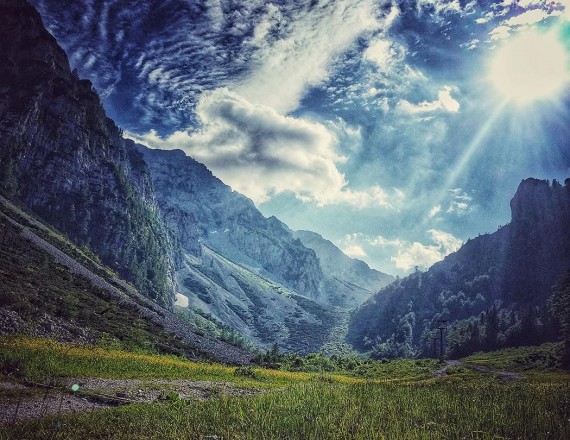
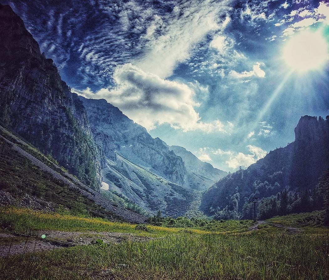
You'll ride through Podljubelj towards Zelenica, which at an elevation of 1560 m is the highest point of a long and physically strenuous route, offering in addition to difficult ascents spectacular views into the heart of the Karawanks.
 1 / 2 K32 - Around Begunjščica and Dobrča
-
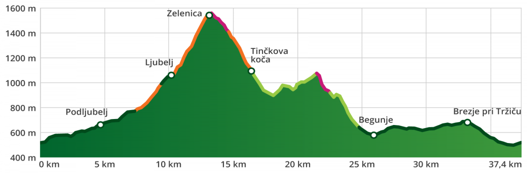
type of path: mountainbike length: 37 km / 5 h elevation change: 1.400 m difficulty: ***** - technical: *** - condition: ***** panorama: *****


ROUTE
Tržič–Ljubelj–Zelenica–Smokuška pasture–Kališča–Begunje na Gorenjskem–Hudi Graben–Brezje pri Tržiču–Tržič
ROUTE DESCRIPTION
The starting point for cycling tours is in the city centre, opposite the Tržič bus station. Parking is possible in public parking areas (parking lots at the Municipality of Tržič, on Predilniška Road at the entrance to the city-BPT, at the Tržič Olympians Hall, along the street Za Mošenikom, among others).
In Tržič, head north through the town centre in the direction of Podljubelj. In Podljubelj ride through the village and continue to Lajb, and from there on towards Ljubelj. Follow the service road along the ski slope to Zelenica Mountain Hostel. Due to the steep incline, there will be places where you’ll need to walk your bike, but soon you’ll reach the highest point on the route.
Take a break and prepare for the descent, which leads past Smokuška pasture towards Završnica. But don’t go all the way down to the end – half a kilometre after Pri Žagi pasture, turn sharply left onto the road that leads across the Završnica stream and up towards Kališče. Ascend to the end of the road, then follow a singletrack trail to the right towards Sankaška Hut. After 300 m, the route branches off to the right, after which you descend to a lookout point at the hunting lodge, offering a beautiful view of the Radovljica basin and Lake Bled with the Julian Alps in the background. Continue down towards Sankaška Hut. When you reach the road and the holiday cottage, go along the road to the left towards St. Peter and then down the road past Krpin to Begunje.
In Begunje na Gorenjskem, follow the main road and the signs for Tržič. A bit more than 12 km of biking remains; first there is an ascent of 150 m, then a downhill stretch through Brezje pri Tržiču and Bistrica pri Tržiču back to Tržič.
Maps
- Karawanks - central part, 1:50 000, PZS
- Stol, 1:25 000, PZS
Rules of the trail for mountain bikers

Please note: The content provided on this site is for informational purposes only. Paths, trails, and roads in natural areas are not signposted. Cycling is permitted on roads and forest roads unless explicitly prohibited. Cycling along logging skid trails, hiking trails, and other footpaths is prohibited unless explicitly allowed. Where cycling is prohibited, cyclists must dismount and continue on foot. Tracks in the .gpx format are for informational purposes only and are meant solely as an aid; they do not necessarily mean that cycling is allowed. Visitors cycle at their own risk.